We respect your
right to privacy!

Cookie settings

By clicking on "Accept" , you consent to use cookies and other technologies (provided by us and other trusted partners). We use such data for anonymous statistical purposes, tailor-made settings and to display personalized content and advertisements. It will help to provide you with an improved website experience. Please find out more about this topic in our Privacy Policy | Imprint

  • These cookies are absolutely necessary for the operation of this site and enable safety related functionalities, for example. Additionally, this type of cookie is as well used to save your personal cookie settings.

  • In order to further improve both our offer and website, we collect anonymized data for statistics and analyzes. By means of these cookies we can, for example, analyze the number of visitors and the effect of certain pages on our website by optimizing our content.

  • We use these cookies to improve usability of the site for you. For example, based on an accommodation search you already made, you can conveniently access the same lodging when you visit our website again.

  • These cookies are used to display personalized content that matches your interests. It enables us to provide you with offers that are particularly relevant to your personally planned trip.

Piccard Loop Trail

The highlight is waiting at the valley’s rear end

Four places of longing inspired our tour: Gurgler Ferner, as the glaciers are called here, Ramolhaus and Langtalereckhütte. For now. They are always in sight, right from the start of the Piccard Loop Trail that stretches on almost 18 kilometers to both sides of Gurgler Ache brooklet. Only the undisputed highlight is still hidden and only surprises at the last minute: the bold construction of the new Piccard Bridge at the very end of the valley, directly at the glacier field.

Mountain Guide Mario

Summer at the back and winter in view

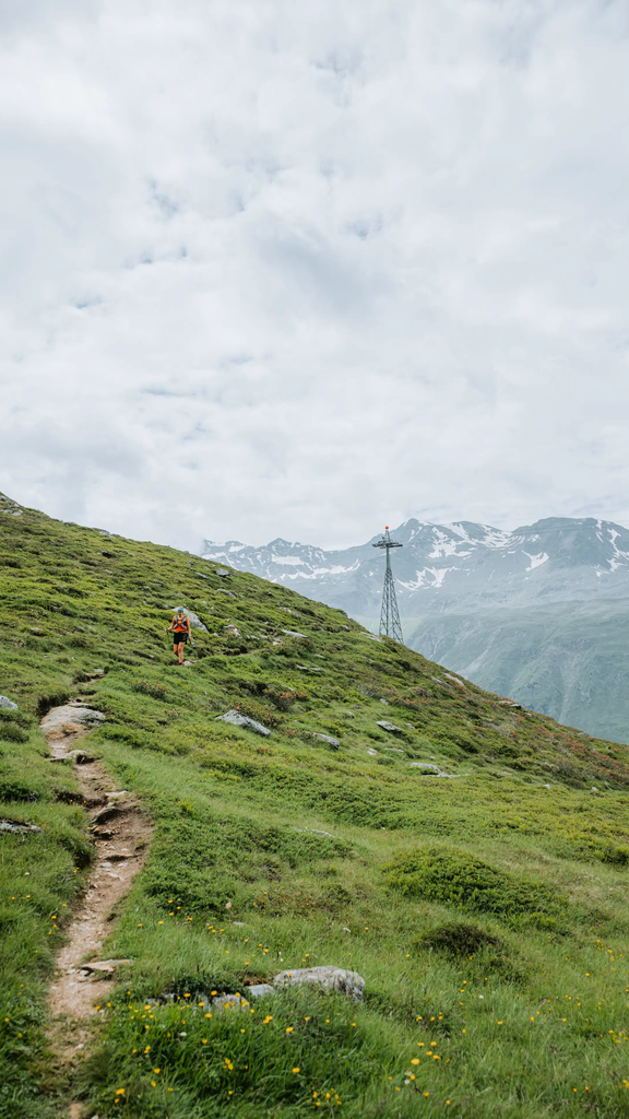
Getting lost is almost impossible. Firstly, bright yellow signposts show the direction and secondly, there is actually only one option. Always straight ahead, the Ache brooklet on the left. Summer at the back and winter already in view. The eternal glacier ice has meanwhile lost its expiration date. And thirdly, I'm on the way with Mario, an experienced mountain guide of Alpincenter Obergurgl.

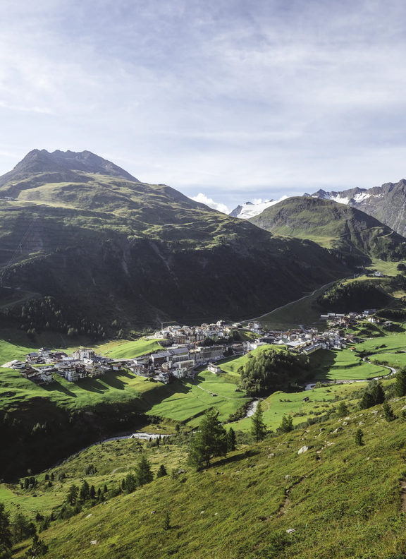
Getting started was easy. From the village center of Obergurgl at 1907 m you just follow the signposted trail to Gurgler Ache brook. From there, steep grass slopes take you to the first orientation point of Küppelealm at 2300 m. The small, decayed Alpine hut is now used by shepherds as a storage point for salt and concentrated food.

We pass a small fish pond that mirrors the snow-topped mountain giants one to one. The higher we hike, the better we can look into the secluded side valleys of Gurgl’s mountain world.

View to Obergurgl
Lake, Nature
Nature, Mountains, Hut, Man

Marmots standing on their hind legs

“In midsummer,” Mario says, “the sun always accompanies you. If you get up early enough, you will be rewarded with particularly beautiful images.” We have to cross several bridges over small torrents that split from Mannigenbach and rush down to the valley. We balance on narrow planks or over stones that someone has placed in the water.

The scent of wild flowers reaches our nose, marmots stand on their hind legs and whistle their warning as loud as a whole fan corner in a football stadium in the event of a foul. Two bearded vultures circling above us, “they have an eyrie with two young vultures here,” Mario explains.

Always parallel to the 12 km long Gurgltal side valley, we soon hike at the same height of Hohe Mut gondola base station, later even at eye level with its top station at 2670 meters. Scenic Karlsruher Hütte, as it is still called by the locals and today bears a bulky name that stretches as long as the valley: Langtalereckhütte is almost within reach.

Small bridge, Manningenbach
Nature, mountains, sheeps
Langtalereckhütte
Over the Manningbach (river)

Ramolhaus as a cloud cuckoo land

Ramolhaus (hut), fog

Like a fata morgana Ramolhaus seems to move into the unreachable distance. At some point we stand directly below the huge rock ledge on which the DAV “Section Hamburg and Niederelbe” hut sits enthroned. Like a painting framed by immense clouds … cloud cuckoo land! What a magical moment. Marco advises: “You underestimate the distance - we still have a long way to go.” I would now like to have as many legs as the funny millipedes that cross our path. Instead, I promise to reduce the number of photo stops. But there is too much to see at every step, at every bend.

Infos Piccard Loop Trail

  • The 18 km long Piccard Loop Trail is moderately difficult and therefore suitable for experienced mountain hikers in a good physical shape. Please find more details about the hiking route HERE
  • Alpincenter Obergurgl is located in Gurglstraße 118, right next to the tourist information office, phone no. +43 664 888 74 212 or +43 5256 63 05 50
  • ou can reach Langtalereckhütte on phone no. +43 664 52 68 655 | HERE you will find the hut's website

Way down to the suspension bridge

Emergency landing on the glacier field

The newly built trail towards Piccard Bridge starts right below Ramolhaus. Built-in stairs and wire ropes lead us through steep rocks. Since the 2017 hiking season, the Piccard Suspension Bridge has spanned the ravine at a height of 100 meters below us.

“The glacier had reached its peak in the 18th century. Back then, you could just walk across the Ferner ice to get to the other side. There was even an ice lake,” Mario reports. The melting glacier tongue made it difficult for hikers to cross the area. Rock falls and floods had damaged the previous bridge several times.

On 27 May 1931, the Swiss stratosphere researcher Auguste Piccard made an emergency landing in the immediate vicinity of the new suspension bridge. A large shiny ball in the center of Obergurgl represents the balloon of the adventurous professor and his assistant Paul Kipfer from Augsburg. They were the first people to reach a height of 16,000 meters and had to make an emergency landing here due to a technical failure.

The event was going through the world press and made the sleepy mountain village famous overnight. "Beautiful, unknown high mountains, gondola and balloon are on a glacier", Piccard had noted in his logbook after the happy landing. An information board on the bridge reminds of his unique adventure.

Group of hikers in front of the glacier
Sign at the Piccard Suspension Bridge
Piccard Suspension Bridge

Extremely homey Langtalereckhütte

Mario and I, on the other hand, seem to have landed on Mars. Red rocks everywhere you look, on the other side of the bridge on the way to Langtal side valley! Most of them are nicely flattened and promise pleasant hiking - the perfect platform for incomparable views of Obergurgl-Hochgurgl!

And finally, long-awaited Langtalereckhütte is getting closer. A refreshment stop! It's really cozy inside the hut belonging to the Karlsruhe Section of the German Alpine Club. “My parents”, Mario introduces me to the senior tenants Melitta and Georg Gufler. “We ran the hut for 42 years,” Siggi states. "In the meantime, we support our son Georg who is the new tenant now." Since the new bridge was built, the hut has been heavily frequented again: "Nobody is afraid to cross the valley basin anymore".

View to Langtalereckhütte
2 People on a motorcross

Flying low on a motocross

While Melitta prepares a hearty meal - "Our specialties are dumplings in all variations, roast pork and goulash" - I take a look around. The hut offers around 70 sleeping places including mattress dorm, hot water and really great luxury: two old tiled stoves. I would love to stay here for hours. But Mario insists on returning.

Fog approaches quickly and it's already so late that he now wants to go back to Obergurgl as swiftly as possible – on his motocross bike. I get ready for the last adventure! The ride reminds of a low altitude flight, Mario speeds down on the dirt road and I can hardly open my eyes.

A pothole has just catapulted us what feels like meters into the air again when we are about to make a soft landing. Just like Auguste Piccard once did. Right next to his silver balloon in the village center. And so, the loop is complete. The loop route too.


(Images: © Ötztal Tourismus, Dagmar Gehm | Info: Guest author Dagmar explored the Piccard Loop Trail in September 2017)

Dagmar Gehm

Guest Author Dagmar Gehm

The renowned journalist and sporty globetrotter from Hamburg has a great passion for the Ötztal and its manifold contrasts and activities:

  • Action – Isolation
  • Thrill of speed – Peace and relaxation
  • Ancient rituals – Trendy hot spots