Gurgl. Diamond of the Alps.
Dein Hideaway im Hochgebirge
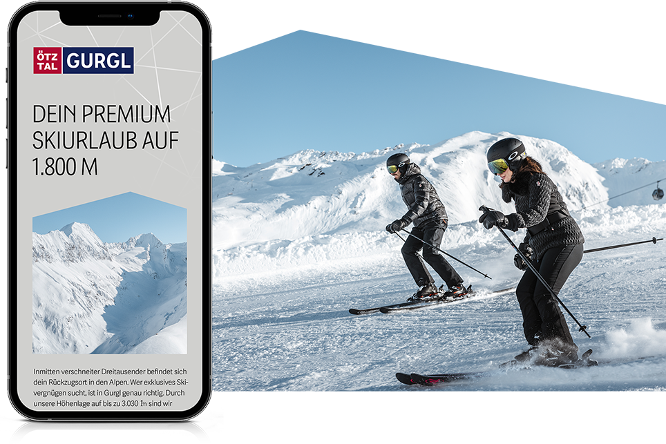
Gurgl ist dein Ort für aktive Erholung in den Bergen. Entdecke beste Schneebedingungen beim Skifahren auf 1.800 bis 3.030 Hoehenmeter und unglaubliche Ausblicke beim Wandern, Biken und Naturwellnessen. Sommer wie Winter erlebst du 3.000er, so weit das Auge reicht, unendliche Weite und absolute Freiheit. Wir leben und lieben die Berge und bieten dir einfachste Zugänge und höchsten Komfort.
Wir starten am 20.11.2025 in die Wintersaison.
Das Skigebiet hat bis 19.04.2026 geöffnet.

Ski Unlimited Packages
4 Nächte inkl. 3-Tagesskipass oder 7 Nächte inkl. 5-in-7-Tagesskipass
Ultimative Vorteilspakete zum Saisonstart - Schneegarantie dank Höhenlage und die besten Inklusivleistungen: Unterkunft, Skipass für 2 Skigebiete & top Highlights. Jetzt buchen und smart in den Winter starten!
- 4 Nächte inkl. 3-Tagesskipass oder 7 Nächte inkl. 5-in-7-Tagesskipass
- Skipass gültig in Gurgl & Sölden
- 1 Eintritt in die Top Mountain Motorcycle Experience
- 1 Eintritt ins 007 ELEMENTS
Gültigkeitszeitraum: 24.11. - 11.12.2025
ab € 499,-


Live aus Gurgl

Michelin-Sterne- & Haubenrestaurants
Ausgezeichneter Genuss in Gurgl – Feinste Aromen, beste Qualität, regionale Zutaten und ganz viel Leidenschaft sind die Prämisse für unsere 4 Haubenlokale in Gurgl. Tauche ein in eine Welt exquisiter Aromen. Lass dich von neuen und bekannten Geschmäckern verführen und genieße ein einzigartiges Ambiente. Hier erwartet dich gastronomische Vielfalt auf höchstem Niveau.
Ausflugsziele & Attraktionen
Das musst du gesehen haben. Vielfalt für deine Auszeit.


Gewinnspiel
Zu gewinnen gibt es ein Skiweltcup-Wochenende Deluxe vom 21. - 23.11.2025 für 2 Personen in Gurgl inkl. 2 Übernachtungen mit Frühstück, 2 Premium-Tickets für den Herrenslalom am Samstag, 22.11.2025.

Gästebefragung
Hilf uns, deinen Aufenthalt in Gurgl noch komfortabler zu gestalten. Teile uns in wenigen Minuten deine Wünsche und Anregungen mit und mit etwas Glück gewinnst du ein besonderes Urlaubserlebnis. Vielen Dank für dein wertvolles Feedback.

Ötztal Inside & Gästekarten
Die kostenlose Vorteilswelt für deinen Aufenthalt im Ötztal inkl. digitalem Reisebegleiter, Gästekarte, exklusiven Preisvorteilen und weiteren Benefits.


Life Goals für dein Postfach
Wir meinen nicht das eigene Business, mögliche Karrierechancen oder Ähnliches. Sondern DIE Life Goals, die das Leben so richtig lebenswert machen. Eindrücke, Erinnerungen und Momente. Hol dir echte Premium-Urlaubstipps in dein Postfach.
Kulinarik & Shopping
Flanieren und großer Genuss. Erlebe Haubenlokale, Shopping-Highlights und mehr.
