

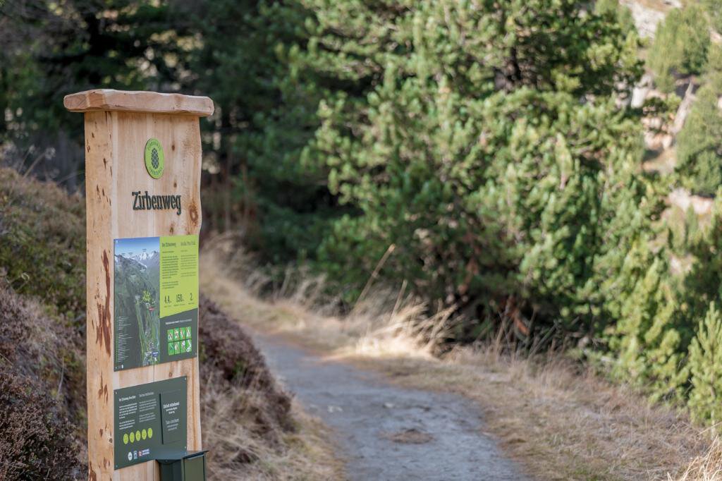


Obergurgl Stone Pine Forest theme route
Map & elevation profile
The Tour
OBERGURGL -> Stone Pine Alm -> STONE PINE FOREST
From Views and Perspectives
The scenic beautiful hike along the newly established Obergurgl Stone Pine Forest theme route delights young and old alike. The fresh air and charming spots invite you to linger. The idyllic path through the approximately 300-year-old stone pine forest teaches interesting facts about the stone pine, animals, and much more. Alternatively, there is the option to hike to the Schönwies Hut: Past the Rotmoos Waterfall, the path leads to the Schönwies Hut, which offers a breathtaking view of the Rotmoos Valley. The Water Strider Trail "Rotmoostal" also passes here. The descent is either back through the stone pine forest or along the forest road.
Rarely beautiful: the Obergurgl Stone Pine Forest
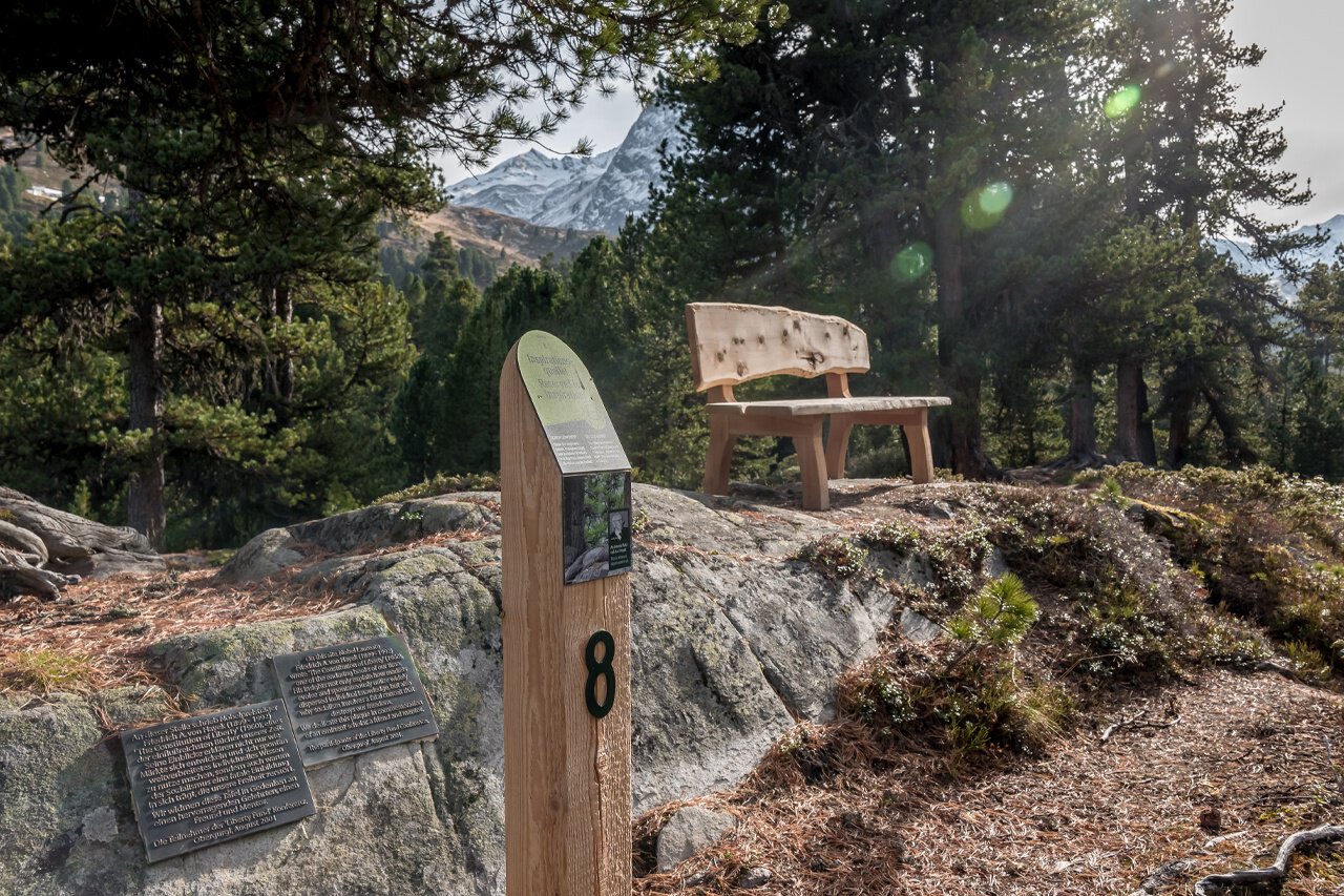
Stone pines often withstand wind and weather alone in the high mountains. A 20-hectare large, closed stone pine forest, such as the one that stretches near Obergurgl from 1,950 m up to 2,100 m on the northern slopes of the Schönwieskopf, is therefore very special. Since 1963 it has been designated and protected as a natural monument in the UNESCO biosphere park "Gurgler Kamm." On the theme route, interested visitors learn all kinds of interesting facts about the stone pine, the forest inhabitants (e.g., the nutcracker), the fauna, and anecdotes about locals. Through interactive offers such as a telescope, the curious can explore the surroundings and look out for bears, cats, and monkeys—for in hunting language these are male, female, and young marmots.
Regions & Places
Mountain areas
Details
Characteristics
Way types
Safety guidelines
Easy hiking trail; suitable for beginners and walkers. Please observe the current weather report at: https://www.oetztal.com/de/sommer.html.
Additional information
More information about hiking in the Ötztal: https://www.oetztal.com/wandern
Directions
The scenic beautiful hike along the newly established Obergurgl Stone Pine Forest theme route delights young and old alike. The fresh air and charming spots invite you to linger. The idyllic path through the approximately 300-year-old stone pine forest teaches interesting facts about the stone pine, animals, and much more. Alternatively, there is the option to hike to the Schönwies Hut: Past the Rotmoos Waterfall, the path leads to the Schönwies Hut, which offers a breathtaking view of the Rotmoos Valley. The Water Strider Trail "Rotmoostal" also passes here. The descent is either back through the stone pine forest or along the forest road.
Shorten with the train or walk all the way
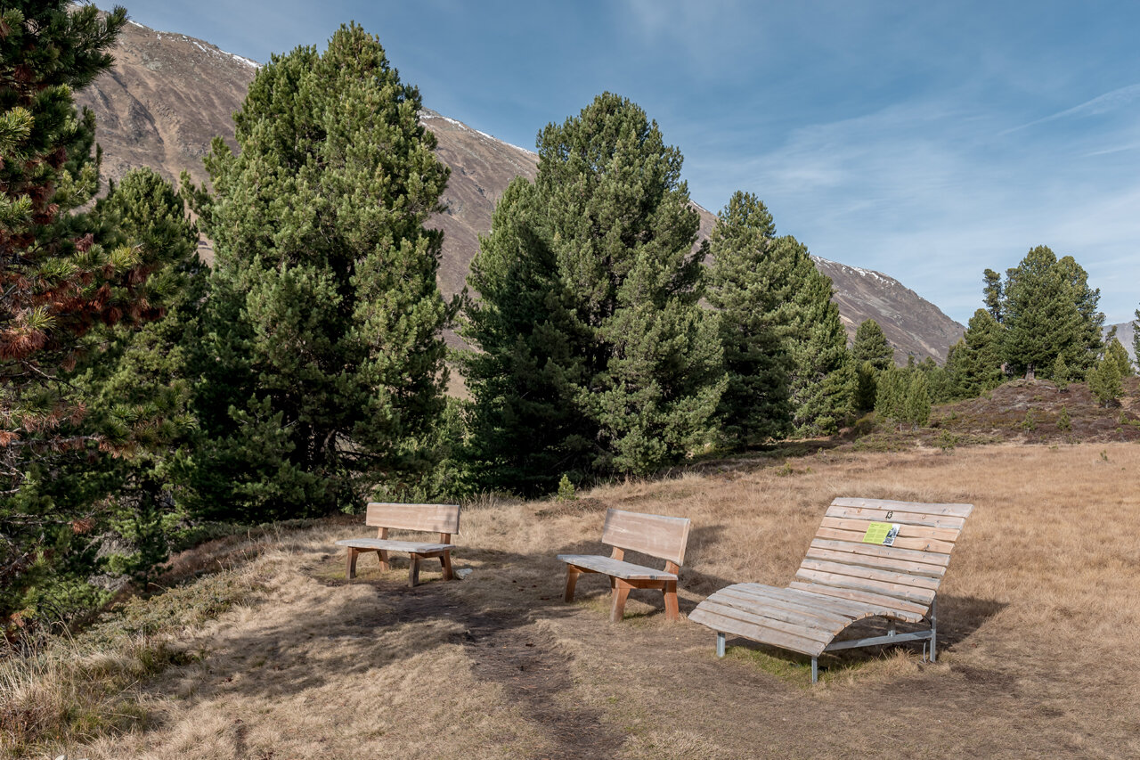
A possible—and especially nice—entry point to the theme route is at the Stone Pine Alm at the foot of the path. Alternatively, there is an entry point halfway up the stone pine forest, just a few steps from the middle station of the Hohe Mut cable car (2,065 m). Those who do not want to use the mountain cable car (free with the Ötztal Inside Summer Card) can hike up from Obergurgl via a forest road. Along the adventure trail with its 15 stations, charming spots invite you to rest repeatedly. If you choose the variant from the middle station, the route runs mostly downhill and child-friendly and ends near the Stone Pine Alm (1,960 m), which scores with dedicated cuisine and great views. Walking the entire route on foot requires about 3 hours for the easy hike. Alternatively, you can hike from the stone pine forest past the Rotmoos Waterfall to the Schönwies Hut and stop there.
Tip: The brochure "From Views and Perspectives – Stone Pine Trail Obergurgl" is available free of charge at the Ötztal Tourism information offices.
Arrival
Public transit
Travel comfortably and safely by train to the Ötztal train station. The final station or exit point is the ÖTZTAL station. Afterwards, you travel conveniently and quickly by public transport or local taxi companies through the entire valley to your desired destination! The current bus schedule is available at: http://fahrplan.vvt.at
Starting point
Getting there
Obergurgl is located in the west of Austria in the state of TYROL, in a southern side valley of the Inn Valley – the ÖTZTAL. For your arrival by car, plan the optimal travel route from your home with the route planner online immediately: https://www.google.at/maps
Parking
The following parking options are available in Gurgl:
- Parking garage Village center Obergurgl (down to the right before the church), paid | € 2.00 per hour
- Parking garage Village entrance – Valley station Festkoglbahn, paid | € 6.00 per day
- Parking lot Hochgurglbahn Valley station, free – no overnight parking
- Parking lot Top Mountain Crosspoint, free
- Parking lot Hochgurgl, free (very small parking lot)
Current information
Equipment
Appropriate equipment such as breathable and weather-appropriate outdoor clothing, ankle-high hiking boots, wind, rain, and sun protection, a hat, and possibly gloves are required for all hikes and tours. Carrying a first-aid kit, a mobile phone, and possibly a hiking map, as well as sufficient provisions on hikes without the possibility of dining, is necessary.