

Alternative route - Ötztaler Radmarathon 2021
Description
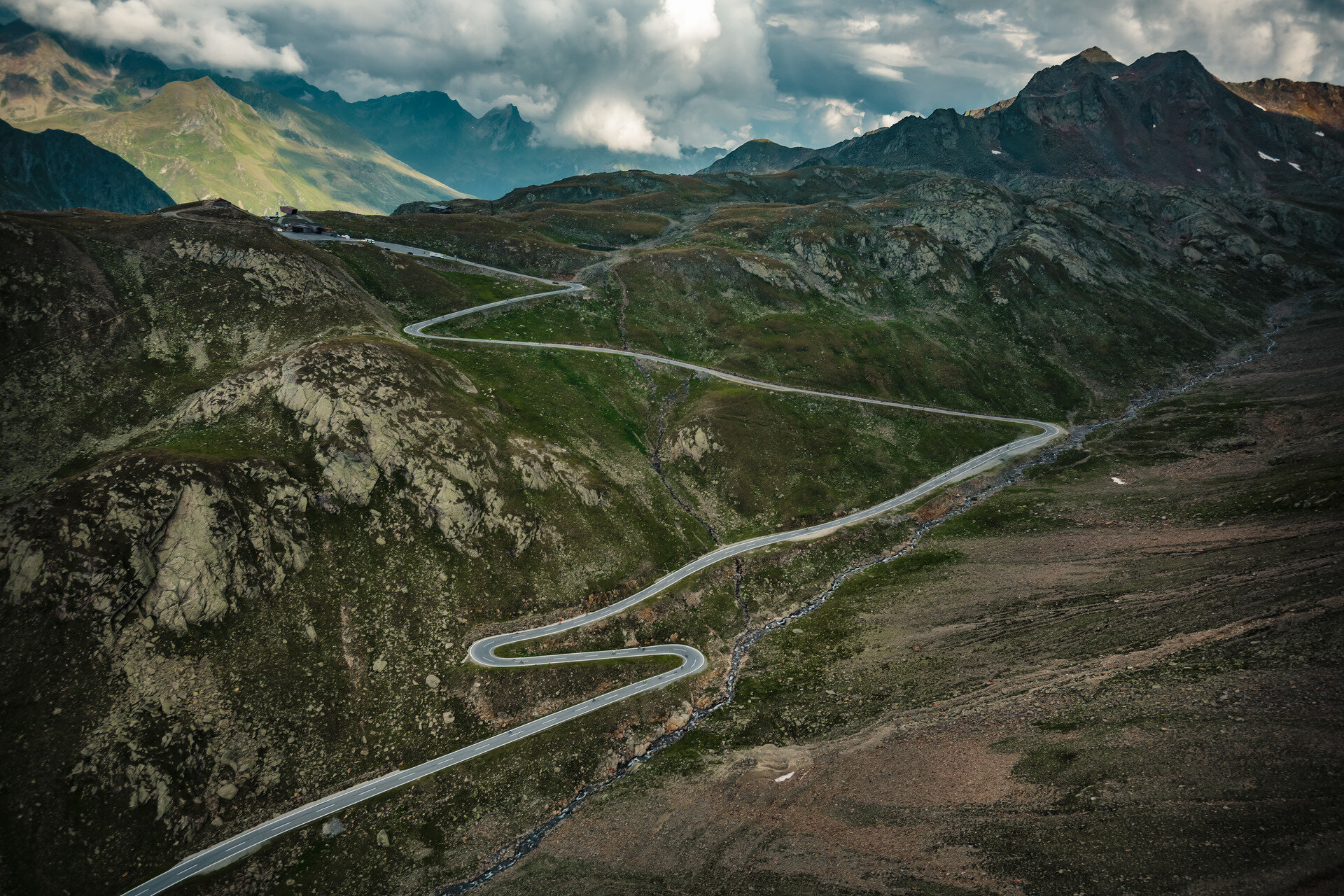
Map & elevation profile
The Tour
Regions & Places
Mountain areas
Details
Characteristics
Way types
Safety guidelines
The Road Traffic Regulations (StVO) apply. General valid and usual rules of conduct.
It should be noted that there can be an increased risk of accidents and injuries in road cycling sports. Despite careful tour planning, there is always a baseline risk. Tour preparation through endurance sports, appropriate training and further education as well as personal prudence reduces the risk of accidents and dangers.
Directions
The route:
Start in Sölden – Oetz 800m - Haiming 670m – Kühtai 2020m – Innsbruck 600m – Brenner Pass 1377m – Sterzing 960m – Jaufen Pass 2090m – St. Leonhard in Passeier Valley 700m – Timmelsjoch 2474m – Sölden 1377m.
The mountain passes:
Haiming – Kühtai (18.0 KM)
1200 meters elevation difference
Innsbruck – Brenner (37.5 KM)
777 meters elevation difference
Sterzing – Jaufen Pass: (15.5 KM)
1130 meters elevation difference
St. Leonhard – Timmelsjoch (29 KM)
1724 meters elevation difference
The refreshment stations:
Kühtai after KM 59.0
Brenner after KM 131.5
Jaufen Pass after KM 163.0
Schönau after KM 201.5
Timmelsjoch after KM 206.0
Finish after KM 237.0
Arrival
Current information
Midsummer-like hot
The tour is within these protected areas.
Equipment
The personal equipment must be safe and functional and comply with the respective technical standard. Every racing cyclist is advised to inform themselves about the planned tours in specialist literature or on site. Complete racing bike equipment is absolutely recommended even for experienced riders!
Tip: For the partly sparsely lit tunnels, lighting is advisable.