

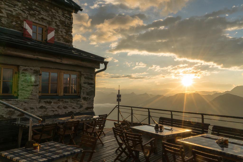

Ramolhaus - Obergurgl
Map & elevation profile
The Tour
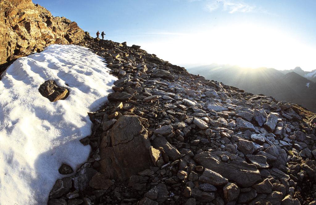
From Obergurgl over the Ach bridge initially somewhat steep up to the "Beil", then a flowery and scenic high mountain promenade over the high pastures of the Gurlg farmers to the Küppele shepherd's hut. From there first steeply uphill, then moderately ascending again to the two "Herrenbächen". From the former material cable car the path turns right in steep switchbacks to the "Köpfele" on which the serviced Ramolhaus stands.
Regions & Places
Mountain areas
Details
Characteristics
Way types
Safety guidelines
Medium difficulty mountain path; suitable for sure-footed and experienced mountain hikers.
Good physical condition, mountain experience and mountain equipment (see under Equipment) are necessary. Please observe the current weather report at: https://www.oetztal.com/de/sommer.html.
Directions
Option 1: From Obergurgl over the Ach bridge initially somewhat steep up to the "Beil", then a flowery and scenic high mountain promenade over the high pastures of the Gurlg farmers to the Küppele shepherd's hut. From there first steeply uphill, then moderately ascending again to the two "Herrenbächen". From the former material cable car the path turns right in steep switchbacks to the "Köpfele" on which the serviced Ramolhaus stands.
Option 2: From Vent through the magnificent stone pine forest to the Ramolalm, from there a steep ascent leads to the Ramoljoch (3,200 m). The descent leads over rocks (rope protection, steps in the rock) to the Ramolferner and further about 30 minutes on foot to the hut. This route is only recommended in good weather and with appropriate alpine equipment.
Arrival
Public transit
Travel comfortably and safely by train to the Ötztal train station. The final stop or exit point is ÖTZTAL station. Afterwards, travel conveniently and quickly by public transport or local taxi companies throughout the valley to your desired destination! The current bus timetable is available at: http://fahrplan.vvt.at
Starting point
Getting there
Option 1: Obergurgl-Hochgurgl is located in the west of Austria in the federal state of TIROL, in a southern side valley of the Inn valley - the ÖTZTAL. For your journey by car, plan the optimal route from your home location with the route planner online: https://www.google.at/maps
Option 2: Vent is located in the west of Austria in the federal state of TIROL, in a southern side valley of the Inn valley - the ÖTZTAL. For your journey by car, plan the optimal route from your home location with the route planner online: https://www.google.at/maps
Parking
Option 1: In Obergurgl-Hochgurgl the following parking options are available: Parking lot village center Obergurgl (down to the right in front of the church, behind the multipurpose building where the information office is also located) Parking meter with coin slot Parking lot village entrance – valley station Festkoglbahn, free of charge – no overnight parking
Parking lot Hochgurglbahn valley station, free of charge – no overnight parking
Parking lot Top Mountain Crosspoint, free of charge
Parking lot Hochgurgl, free of charge (very small parking area)
Option 2: In front of the village and at the valley station of the chairlift (paid)