


Martin Busch Hut
Map & elevation profile
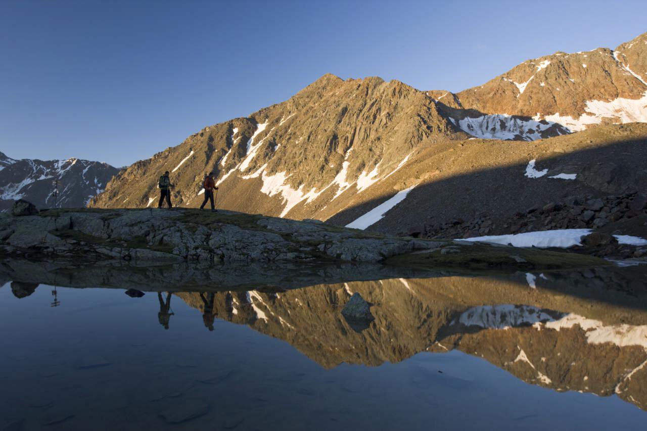
The Tour
From Vent to the Ochsenkopf, halfway up turn left into the Nieder valley. On a wide path past the newly built chapel and the shepherd's hut on a moderately ascending trail to the hut.
Reservation of sleeping places in the hut necessary!
Regions & Places
Mountain areas
Details
Characteristics
Way types
Safety guidelines
Additional information
More info on hiking in Ötztal: https://www.oetztal.com/wandern
Recommended literature
Recommended maps
Kompass #042 | Inner Ötztal and Pitztal, Gurgler Tal, Venter Tal | 1:25,000
Kompass #43 | Ötztal Alps, Ötztal, Pitztal | 1:50,000
Freytag & Bernd WK 251 | Ötztal, Pitztal, Kaunertal, Wildspitze | 1:25,000
Kompass | Bike & hiking map Ötztal | 1:35,000
Directions
From Vent to the Ochsenkopf, halfway up turn left into the Nieder valley. On a wide path past the newly built chapel and the shepherd's hut on a moderately ascending trail to the hut.
Arrival
Public transit
Travel comfortably and safely by train to the Ötztal train station. The final station and exit point is ÖTZTAL station. Then travel conveniently and quickly with public transport or local taxi companies throughout the valley to your desired destination! The current bus timetable is available at: http://fahrplan.vvt.at
Starting point
Getting there
Driving into the ÖTZTAL. Located in Tyrol, the ÖTZTAL branches off southwards as the longest side valley of the Eastern Alps. Traveling by car, visitors drive through the Inn valley to the entrance of the valley and continue along the Ötztal. Besides the toll motorway, country roads can also be used. Your trip can be quickly and easily determined with the route planner: To the route planner: https://www.google.at/maps
Parking
At the entrance to the village (summer only)
At the valley station of the Wildspitze double chairlift (DSB Wildspitze)
At the Mountaineers’ Chapel
Further information can be found here:
https://www.oetztal.com/en/regions-villages/parking
Current information
It's getting noticeably cooler
Not too warm